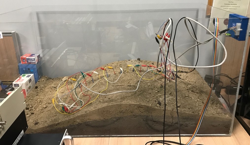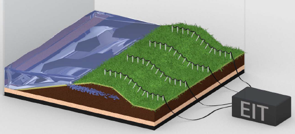
We present a modern ETI (Electrical Impedance Tomography) scanner designed for precise and non-invasive imaging of moisture levels in earth dams, embankments and flood embankments. The device, equipped with advanced software based on machine learning, is an irreplaceable tool in monitoring and assessing the safety of hydrotechnical facilities.
Functionalities
- High imaging resolution
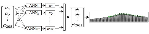
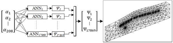
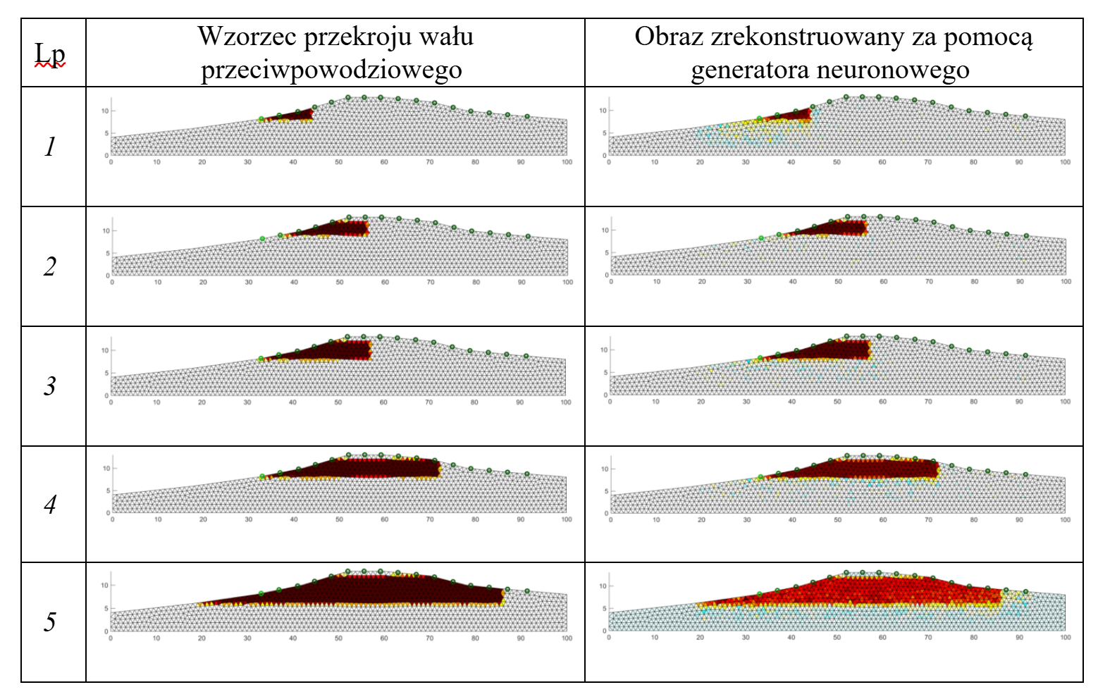
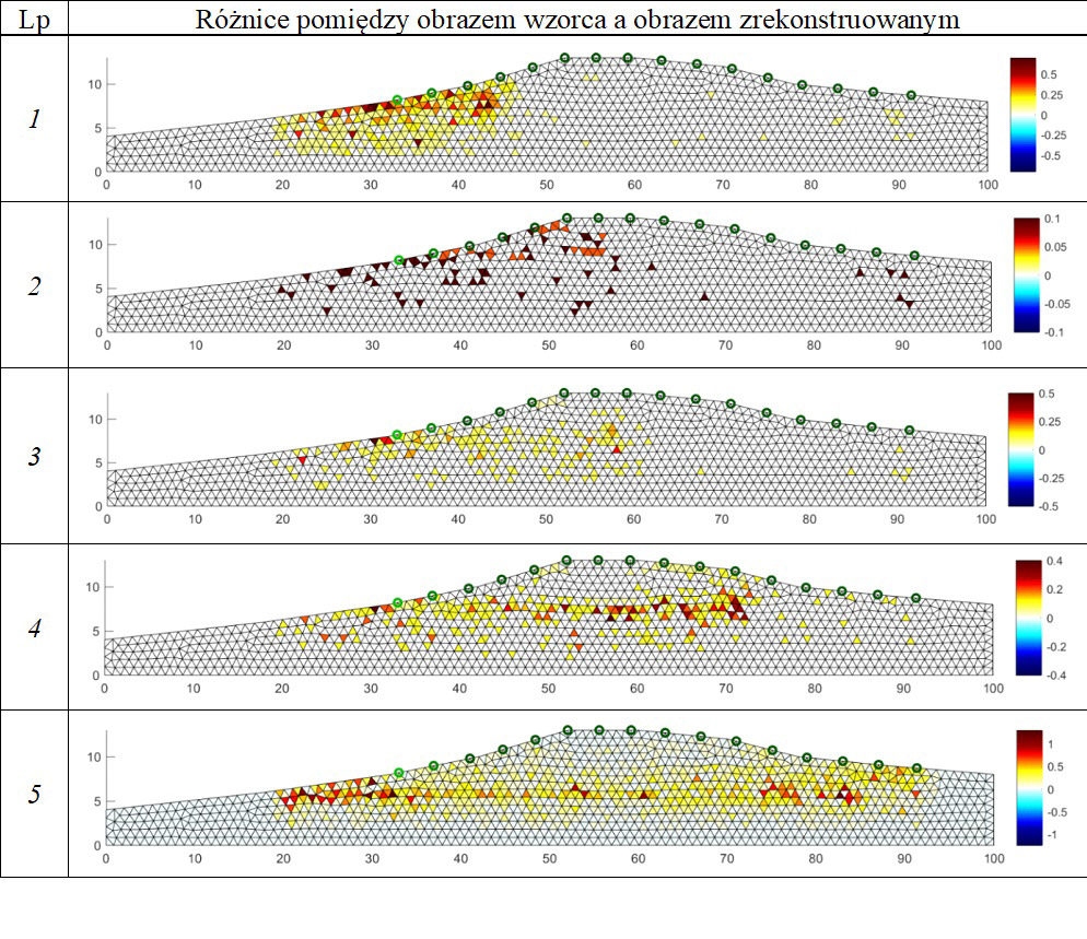
Thanks to the use of a system of many artificial neural networks, the scanner allows for obtaining high-resolution images, which allows for early and precise detection of potential operational hazards.
- Zaawansowane algorytmy rekonstrukcji
The software uses innovative image reconstruction methods, such as LSTM, CNN, Lasso and ElasticNET algorithms, which improve the quality and accuracy of the obtained data.
- Fast real-time analysis
The system allows for ongoing monitoring of the technical condition of dams and embankments, which is crucial for ensuring their reliability and safety.
- Non-invasive and safe
The ETI method allows for the assessment of moisture status without the need to interfere with the structure of the object, which is particularly important in the case of objects of strategic importance.
- Versatility of applications
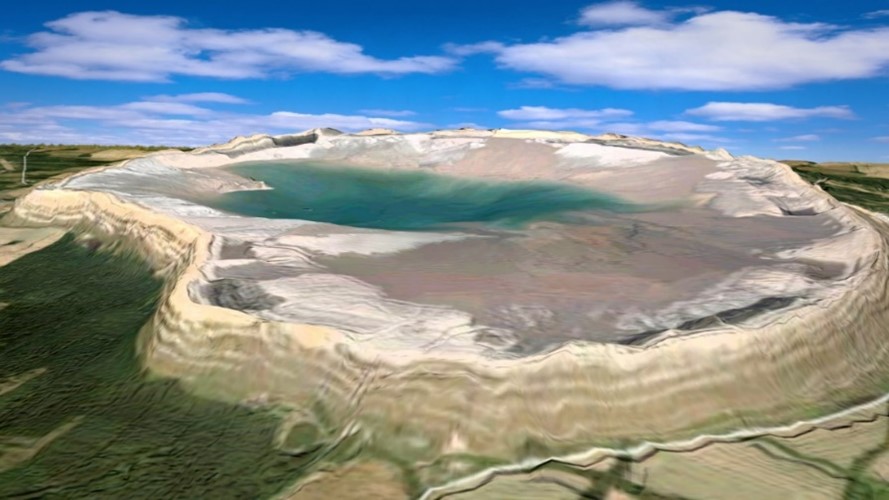
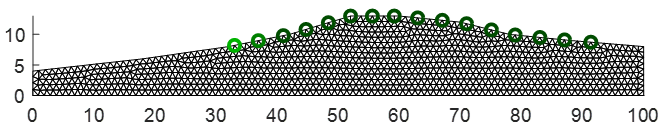
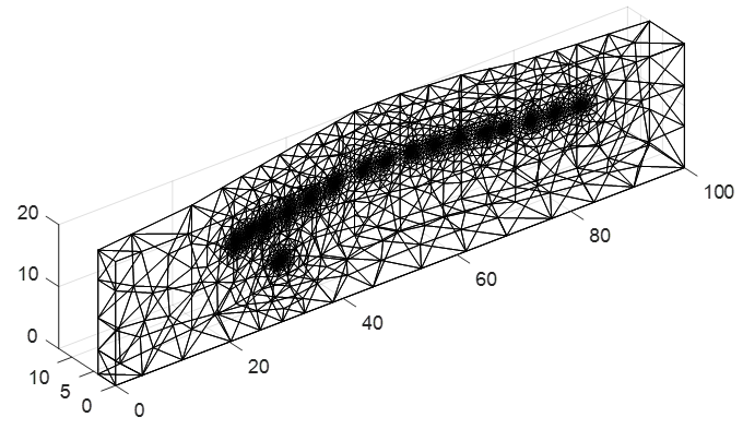
The tomograph can be used to monitor both earth dams and flood embankments, as well as other hydrotechnical objects requiring moisture status assessment.
Technical specification
- Technology – electrical impedance tomography (ETI)
- Software – advanced machine learning algorithms
- Application – monitoring and diagnostics of hydrotechnical objects
Practical applications
- Monitoring the technical condition of dams and embankments – regular assessment allows for early detection of irregularities and taking preventive measures.
- Evaluation of the effectiveness of repair works – after repairs, the system allows for verification of their effectiveness.
- Planning of maintenance works – thanks to precise data, it is possible to optimally plan maintenance activities.
By choosing our ETI tomograph, you are investing in a modern and reliable solution that increases the level of safety and efficiency of hydrotechnical facility management. Contact us for more information and to tailor the offer to your needs.